
Along the Avenue of the Volcanoes
by Randall Thomas // photos by Zac Robinson
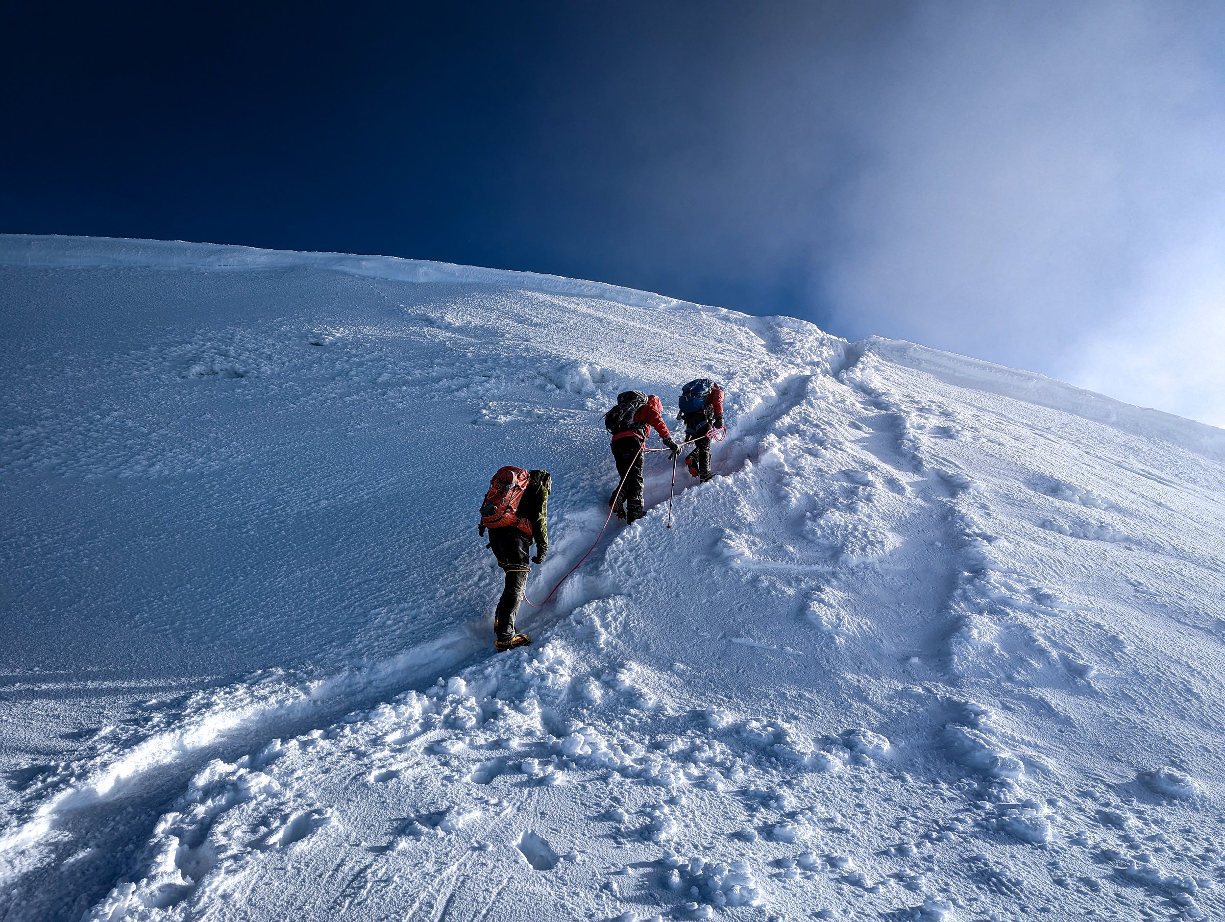
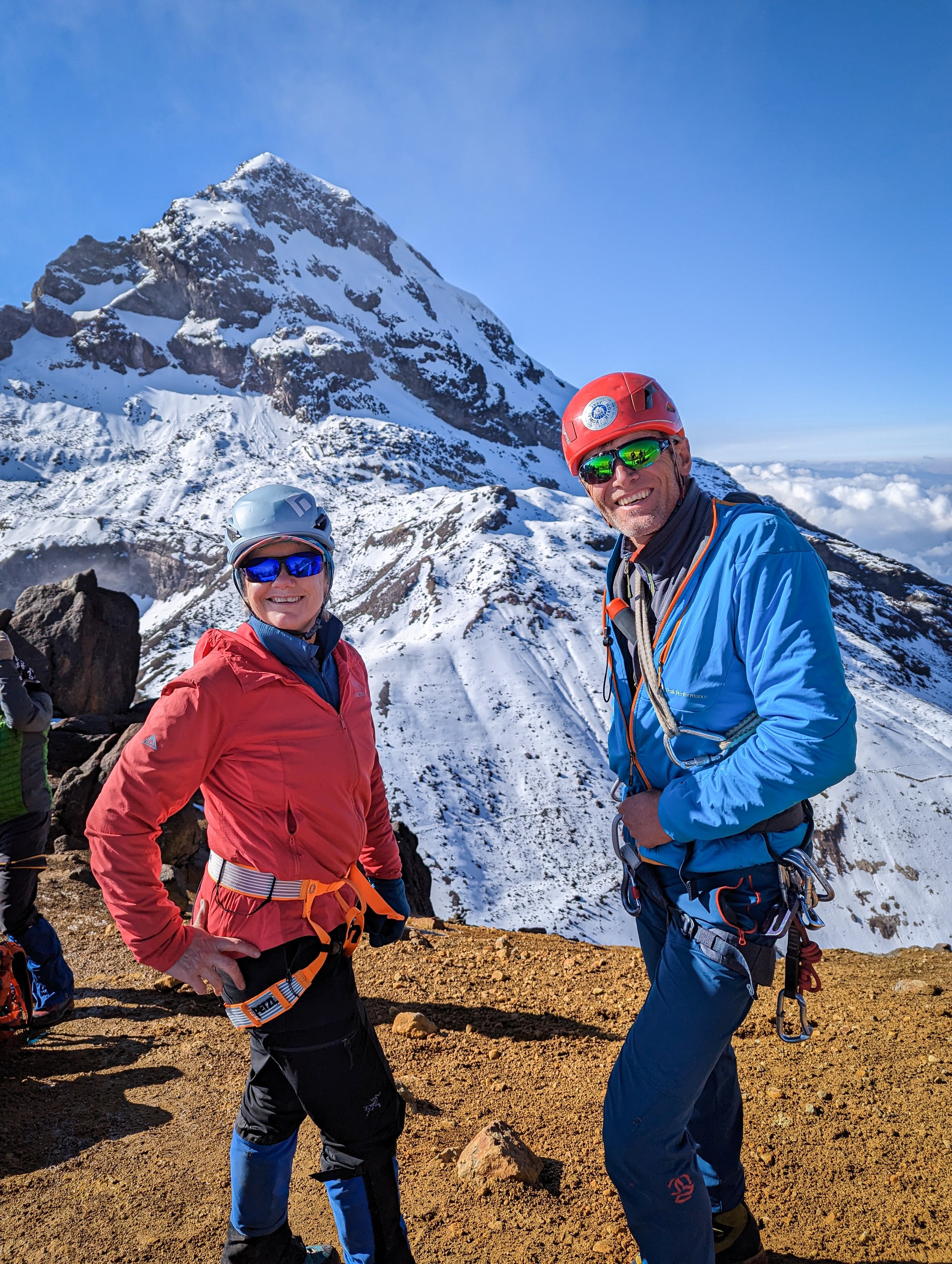
Pedro, Ken & Randall approaching Cayambe summit dome on the 2023 Ecuador international trip.
What brings a group together? There are at least as many answers as there are people in the group, but for the ACC Adventure in Ecuador, one reason we had in common was a starved wanderlust—the pandemic had demanded sacrifices of us all. Now here was a chance to rejoin old friends, meet new ones, experience a different culture, face some physical challenges and maybe tie up some loose ends. You could also add historical curiosity, a geographic anomaly and simply an escape from winter to the list.
Whatever the reasons, what sealed the deal was the leadership of Helen Sovdat, whose adventures far and wide have brought new cultural and geographic perspectives to us all.
• • •
The migration began on January 14th as we all followed the centripetal pull from approximately 50 degrees north to 13.5 minutes south; we inserted ourselves into the clockwork tour via Vancouver, Toronto, Miami, Houston, Bogota and/or San Jose.
January 15 – Arrive in Quito (2,850m)

An acclimatization walk among the cobbled streets of Quito, towards the statue on the horizon.
For those already in place, a day of meandering through the city was planned to take in various points of interest and add some vertical to start the acclimatization process. This included a stair-climb up to the Virgin of el Panecillo. The last of us arrived at the hotel just after midnight.
January 16 – Condor Machay waterfalls hike (approx: 3,100m)
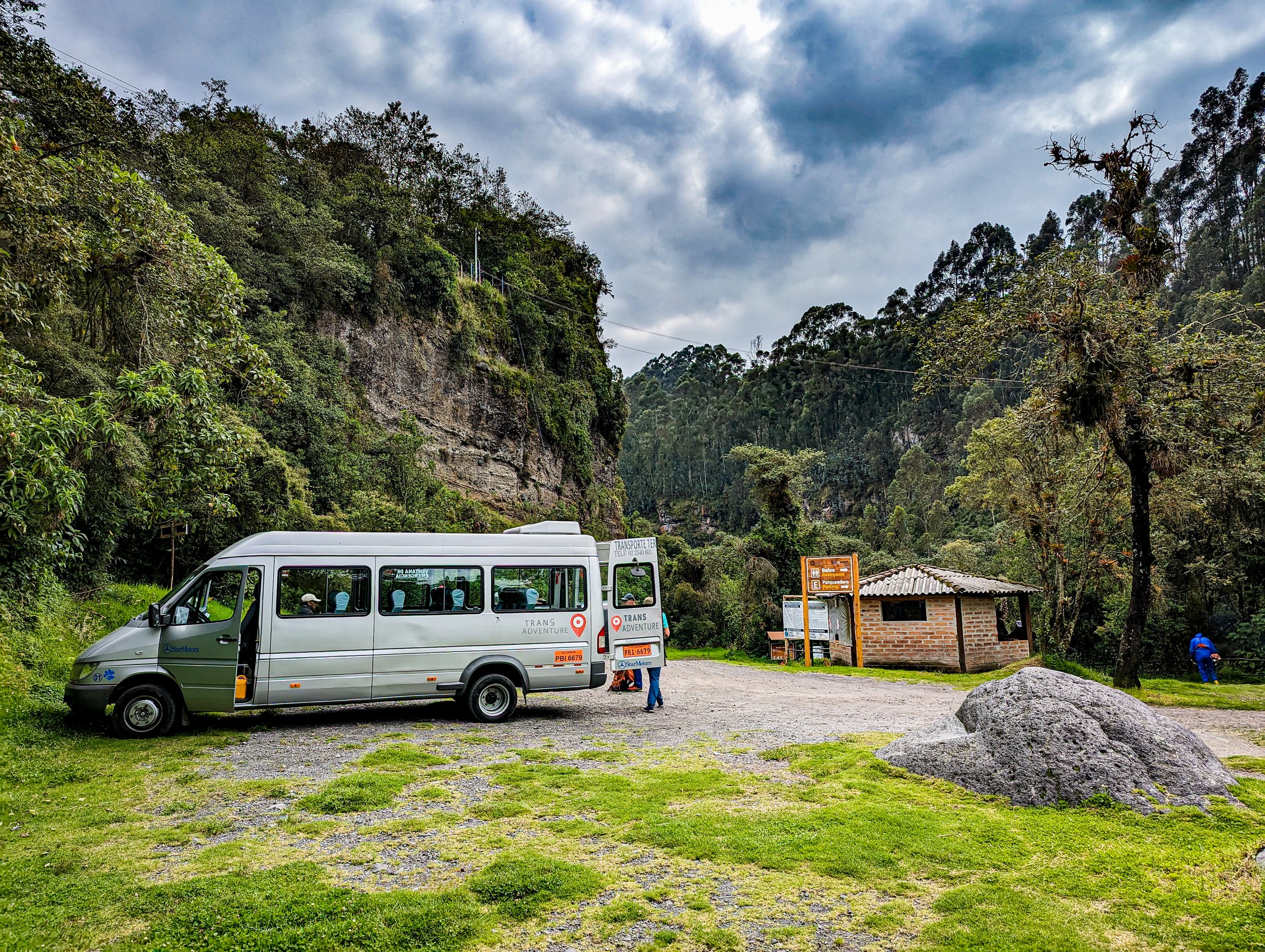
At breakfast, our local guide, Benno Schlauri, thought it best to get us right into some higher walking. “Now we begin the acclimatization. All your fitness training is over; it's too late for that now.” Fair warning. We all climbed into the 11-passenger Mercedes Sprinter van, and Nelson, our indomitable driver, took us out of the Quito rush-hour. There really weren't any horrible seats in the van, but one couldn't escape the myriad speed bumps and cobblestone roads. We burst out of the vehicle like homing pigeons any time it stopped.
There were two options at the trailhead, so we first hiked slowly uphill to the main attraction, an 80-metre waterfall that spilled over basalt cliffs and into the Pita River after winding its way down from the slopes of Cotopaxi (currently closed to tourists due to a constant plume of ash from the caldera). Along the way, crossing about ten bridges, we witnessed an astonishing variety of plants: epiphytes/bromeliads; puya aequatorialis; fungi; orchids; mosses; eucalyptus trees. Fauna in the area included a brown frog, three black-headed vultures, caracaras and some white-capped dippers.
We returned to the van to regroup, then set off downhill on what amounted to an obstacle course of ladders and swaying bridges. At the end of it was a spectacular viewpoint looking down the gorge and up at more overhanging basalt cliffs. Gazing at the smooth, sharp cut-glass forms, it wouldn't be a stretch to suggest that Gris, Braques or Picasso developed cubism upon seeing such a landscape. Soon enough, we retraced our route, which proved to be a bit of a workout considering we were moving uphill above 3,000 metres.
January 17 – Cable Car (3,117m - 3,945m in 20 minutes) and Pichincha walk (4,270m)
We were up over 4,000 metres by 10:00 a.m. and off towards Pichincha for as long as the weather held. While inhaling clouds, we enjoyed a refresher on mindful walking—essentially getting the most out of one's skeletal structure to conserve energy—and Benno introduced us to the chuquiragua, the Ecuadorian mountaineers' “edelweiss” (unlike its Alpen counterpart though, an abundant, green and orange shrub). We lunched while the sun poked in and out of the rising clouds (I ate my first grenadilla) and beat a retreat to the teleferico to return to the hotel to pack.
January 18 – Pasochoa (4,200m) and Chuquiragua Lodge
Out on the road, we retraced the route to the waterfalls then continued further to the trailhead for Pasochoa. We hiked in the mist along a greasy road where patches of African palm-nut shells were scattered for traction on the rich black dirt. The landscape surrounding us was carpeted by paramo. This is a wild grass that grows in tall, spiky clusters which can provide good handholds when traversing slippery slopes (imagine what it might be like to walk among thousands of angry porcupines).

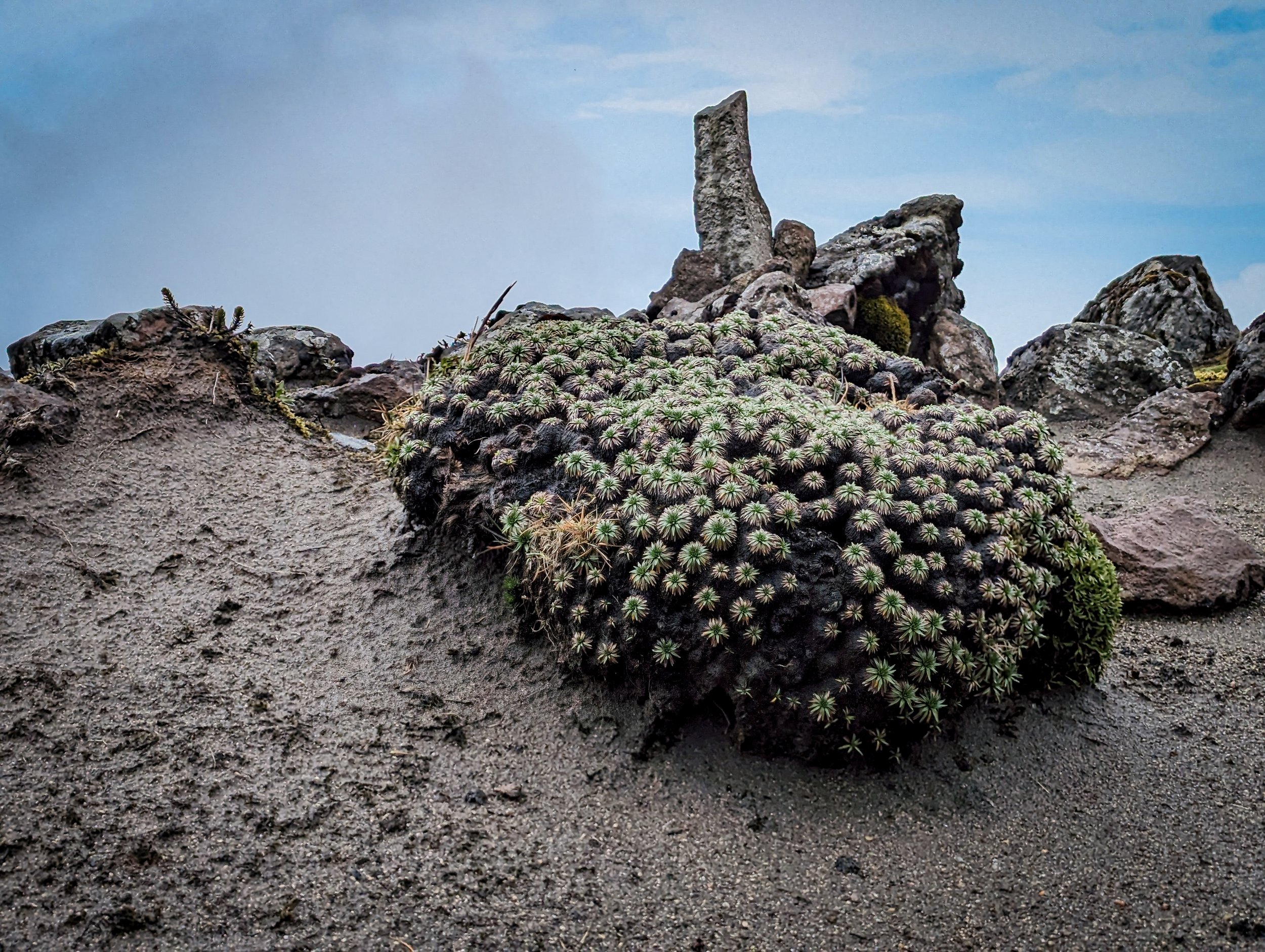
Dense paramo at the trailhead for Corazon.
While the weather cycled through its usual afternoon deterioration, we galumphed our way up onto the summit ridge, took some time to rehydrate and then returned to the trailhead, but not without a few mucky incidents. Micro-spikes would have been useful in some spots.
We arrived at the Chuquiragua Lodge with plenty of time to unpack, shower and put on dry clothes for dinner. The buildings were decorated with all manner of antiquities: rusty typewriter, wall-phone, washbasin and mirror, collections of woodworking tools, riding tack etc. Other tour groups were also about, and we soon learned a sizable number of adventurers were more or less on the same regimen of acclimatization as us, with Chimborazo as the goal. Outside, the rain hammered the lodge, and snow began to blanket the surrounding slopes.

Approach trail to Pasochoa (summit is double-hump straight up from orange pack via left skyline).
January 19 – Corazon (4,790m)
An ill-favoured wind brought more damp weather for our day up Corazon, and while we all beseeched Ken (our own private meteorologist) to do something about it, he seemed quite content just to elaborate on the various forms of precipitation we encountered as we crossed the paramo and tramped up onto the barren ridge: virga, mist, light rain, ice pellets, graupel, snow...
Four of us were working our way up a gulley to gain access to the final summit ridge when a flash behind/above/below made me wonder why anyone would be taking a—CraaAAAACK!
Benno ahead of us. Helen behind.
“Everyone, back down! NOW!”
We scurried down. We huddled. The storm's thunder moved slowly away; we high-tailed it back down through the paramo and eventually reached the van.
Another night at lodge, safe from the rain with bottomless mugs of tea and a hearty meal. Tomorrow we would pull up stakes again.
January 20 – El Chaupi campsite (4,000m)
Day five of huevos for breakfast, plus fruit and coffee and bacon. A rest day of sorts, where we all packed up and piled into “VanNelson.” (It needs to be emphasized here that, while our nightspots were out of town, Nelson actually returned to his home on the eastern side of Quito each night and met us each morning with full tanks of petrol and water—surely the hardest working member of the team.) We had a leisurely 10:00 a.m. departure, a short drive, then a two-hour walk to the campsite by the Illiniza trailhead. Our duffels had been ferried up to the site by Parks vehicles, and when we got there, a line of bright yellow North Face tents greeted us along with large cooking & dining tents.
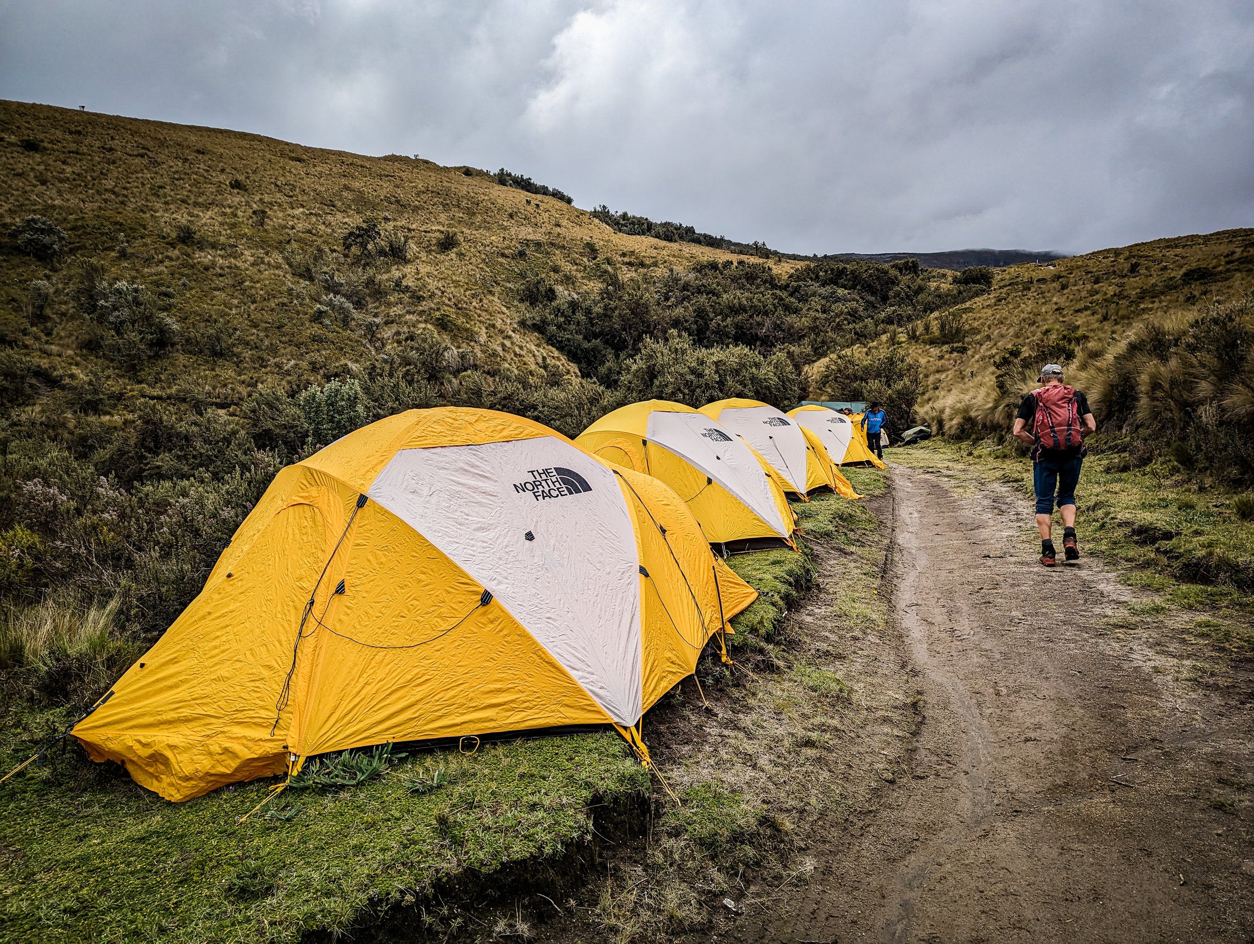
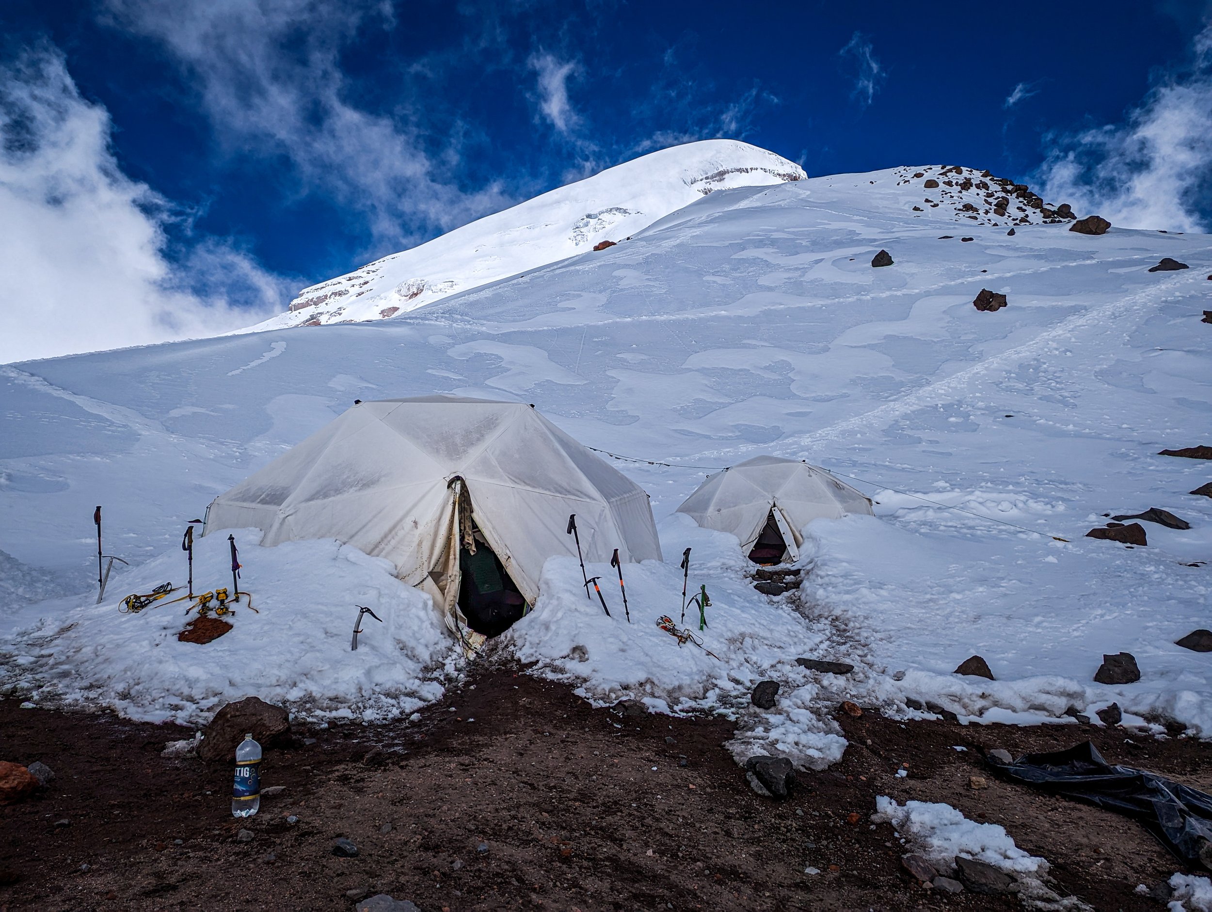
The Illiniza camp with its individual tents for two. Tents for cooking and eating are at the bottom.
I'd hoped to get in some star-gazing but the unsettled weather had obscured the sky. I turned in, facing a 3:00 a.m. wakeup—we were shifting to alpine starts, which underscored a slightly more serious tone to the trips ahead. It's worthy of note that the acclimatization process, while adhering to the “climb high, sleep low” maxim, also had a regular pattern to it: we were getting higher by about 500 metres each time.
January 21 – Illiniza Norte (5,248m)
Up and on the trail by 4:00 a.m., we were able to get some early morning stargazing in, after all. When we stopped for a break in the thinning paramo, the Milky Way blazed overhead. At the next stop, as Mercury preceded the dawn, our first view of a smoking Cotopaxi reminded us we were on the Avenue of the Volcanoes.

Illiniza before dawn (Cotopaxi in the distance).
We reached the refugio (4,700m) with clear skies above and a sea of clouds in the surrounding valleys. The north summit ridge rises from the col in broken rock which is nothing more than occasional scrambling; any difficulties were skirted to the left. To our right, Cotopaxi reminded us how tenuous the landscape could be. Following a steep traverse in snow, we donned crampons for the final gulley and grated and scraped our way over the last few metres of rock to the top. Clouds were rising up quickly around us, so after some pics and eats, we headed back down.
Helen and Benne at Illiniza col (Illiniza Sur in background)
We made the return route in good time, not retracing our steps but continuing down west until we hit scree, sand and pumice (a texture not unlike the vermiculite my dad used to put in the bottom of his barbecue). Soon we hooked up with the main trail and were down to camp at 2:00 p.m. for soup, yuca tortillas and tea. By 3:00 p.m. we'd packed up, loaded our bags and ourselves into three Parks vehicles and rode down to the trailhead to meet “VanNelson.” A quick transfer and on the road again, this time north to Guaytara Lodge less than half a degree south of the equator. Nestled in a labyrinth of hills, the lodge sits behind a ridge where the largest aerie of condors in the world can be found; an estimated 15 of them live and soar there, and with the possibility of seeing them in the morning, we went inside for dinner and a good night's sleep.
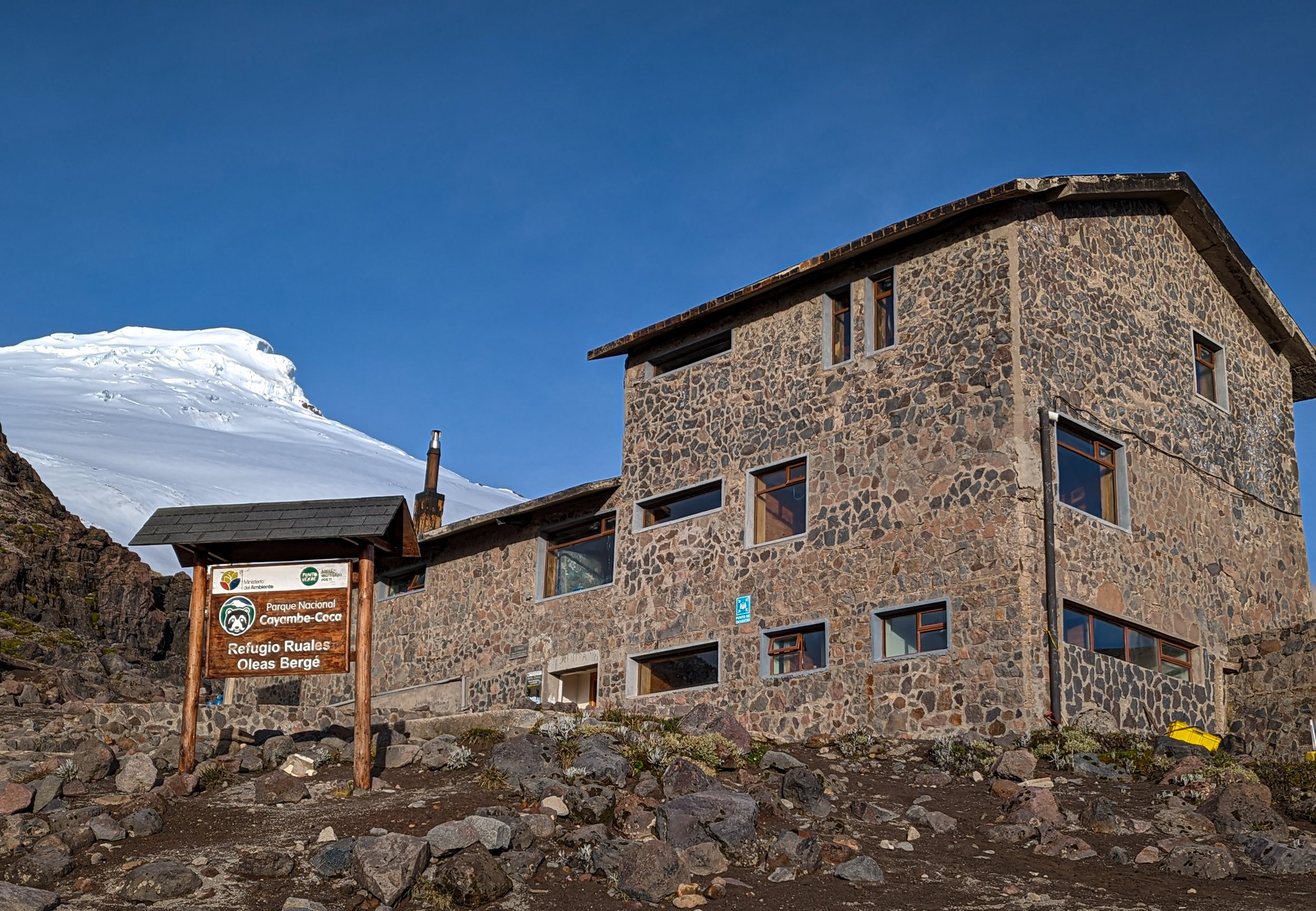
January 22 – Refugio Cayambe (4,600m)
Up before breakfast, I grabbed a coffee and joined Zac and Carl on the front paving stones to scan the skies. In the space of about 15 minutes, condors alone, in pairs, and as many as five at a time all circled in the updrafts.

Carunculated caracara alighting.
Fed, packed and away by 8:00 a.m., we were now bound for Cayambe north of the equator. Recent reports of the roads in the area indicated we would have to walk up certain sections under construction. In actuality, we walked about 30 minutes, got picked up by a posse of 4x4s and deposited at a rough stretch of road that was maybe another ten minutes of walking. Then more vehicles gathered us up and took us to the lodge.
We were all together in the dining area by 4:00 p.m. The tempo of activity accelerated: dinner and dessert; Benno outlined the timing and route description; packing for an alpine start; one last look at the stars, and off to bed.
At 11:00 p.m., Benno's wakeup call pushed everyone into action, dressing, repacking, breakfasting...
January 23 – Cayambe (5,790m)
Gathered outside the refugio, we were eager to squeeze the most out of the day. We set off at midnight. There's something surreal about walking single-file with headlamps on: the field of view is so narrow, your mind starts to form shapes in the stygian periphery. The rhythms of the lamps behind you become searchlights and everyone's shadows writhe and twist on the rocks and snow around you. You're living in Plato's cave and all you want to do is step...step...step to keep in time with the person in front of you.
After winding up through the headwall and down onto a flat space, we stopped to don crampons. Now the march had a steel-section accompaniment to the psychedelic light show of Plato's Cave: Shhhuk!...Chik!...Chik!...Shhhuk!...Chik!...Chik!... It would have been easy to succumb to this siren song, but as we edged higher up onto the glacier, a savage headwind slapped some sense into us and any hallucinations were soon replaced by the reality of a gray-dawn remoteness. Blasts of ice particles bit at our faces and began to coat us with rime.
The upper section loomed in the gathering light, with steep sections to a sort of bergschrund, a narrow walk along a crevasse (thankfully sheltered), then a final staircase to the domed summit. Pedro, Ken and I leaned into the buffeting winds. I saw what Ken later informed me was a Brocken spectre (my shadow cast on the clouds beyond us), complete with a halo. Fighting the gale, Helen clutched a small Canadian flag for us to pose with. Then, before insanity took hold, we started down. Unable to actually see the route on the way up, the descent was interminable. Thanks to Pedro's stewarding, Ken and I picked our way back to the refuge by 10:30 a.m.

Cayambe Summit: Zac, Helen, Ken, Pedro and Randall.
Meanwhile, Benno, Julie and Carl had summited first, about an hour ahead of us; Helen and Zac preceded us to the refugio by a half hour. Bibi and Sonja had turned back at 5,566 metres—Bibi was feeling nauseous and short of breath, exhausted from fighting the wind.
Together again in the refuge's relative warmth, we ate and drank, packed up and returned to Casa Q for a well-deserved sleep.
January 24 – Rest day in Quito (2,850m)
After breakfast we wandered out on errands that took us first to a mall, then to an artisan market, then to lunch, and back to our rooms to unpack, repack, and prep for Chimborazo.
January 25 – Chimborazo High Camp (5,300m)
Back on the road, with a five-hour drive south to the Chimborazo environs. Benno decided to make the trip a circumnavigation of the volcano, so we circled the east side and entered the park. The stone buildings at the entrance were a marvel of craftsmanship. Hummingbirds flitted about the rabbit-ear plants and poked around the niches of the walls. After filing the necessary paperwork, we set off toward the refuge. Vicunas grazed on the desolate slopes, and while we rumbled along the switchbacks, the mountain didn't seem to get any closer. I must have drifted off, because suddenly we were at the refugio, and people were getting out of the vehicle. An Andean fox eyed us opportunistically.
Julie, Bibi, Sonja and Ken had decided not to make the attempt on Chimborazo. They stowed their overnight gear in the refugio, then joined Benno, Pedro, Mauricio, Helen, Zac, Carl and I on the hike up to the High Camp. After about 45 minutes, we hit hard snow and donned crampons.
The High Camp is amazing: Four white geodesic half-domes sit on a bench that overlooks the refuge and the park entrance, but it's virtually invisible from below. Our sleeping tent floor was strewn with dense 3' x 7' gymnastic pads, so comfort wouldn't be an issue. The combined kitchen and dining tent had a table for about 12, and we all sipped tea, nibbled cookies, then parted ways as other groups checked in.
The plan for those of us staying up was an early supper, up at 11:00 p.m. and away by midnight. Those staying below would hike to the Whymper Needles with Mauricio the next day.
As Benno briefed us at dinner, the reports of the upper part of the route were not favourable: lots of snow, and no broken trail above 5,800 metres. But, we'd go have a look. I crawled into bed and tried to sleep.
January 26 – Chimborazo (6,263m)
With my double boots on, I felt like Herman Munster traipsing along on the first part of the route. The sky was clear and we were making a long traverse toward the right again, in a headlamp shuffle. Benno had Carl in tow, and Pedro and Helen had me in between on a short line. Zac had awoken to a splitting headache and withdrawn from the climb.
Once the traverse turned uphill, I could feel my energy waning. I persevered for another hour, but by the time we'd reached the rocky section that required a bit of scrambling, I had to stop and assess. Given how bagged I'd been on the descent of Cayambe, I knew if I pushed on I'd run out of gas, and it's not like a football field where you can give 100% every play and let the trainers carry you off. Maybe knowing what lay above had settled the matter in my mind as well: avalanche potential.

Helen leading the march up to Chimborazo High Camp from the refuge.
Helen pushed on with Benno and Carl; I decided to turn back. Under Pedro's watchful eye, I descended to High Camp by 3:00 a.m. Neither cold, nor disappointed, I sat outside the tent and stared up at the sky for half an hour, picked out the constellations, watched distant storm cells light up their cotton canopies, and savoured the view before turning in.
I heard Helen and Carl come in around 5:00 a.m.
"What happened?"
"Unstable slopes. Everyone's turned back."Dawn came, then breakfast. We descended to the refugio. Hugs all around once the group was reunited, then we packed up under a brilliant sky and headed back to Quito.

Left to right in front - Ken, Bibi, Sonja. Left to right in rear - Pedro, Carl, Zac, Mauricio, Helen, Randall, Julie, Benne, Nelson.
Back in Casa Q, a last supper at Sinner's gastropub down the street, then everyone packed for the journey home. The amount of stimulus in that 12 days was overwhelming, more than enough to feed a wanderlust deprived for several years.
January 27 – Transfer to airport, fly home (1,090m)
Funny how the dry -15° air in Calgary is less tolerable than the -10° at High Camp. Was it a change in latitude, or a change in attitude?
• • •
As I write, it's been three weeks since I got home. The scope of the trip—the shared challenges and moments with friends—comforts me like a duvet, deflects everyday stress like armour, and gives me reason to smile behind a cup of coffee. The anticipation and expectation is gone now. What remains is a satisfaction in knowing I can and will do it again.
And that's the seed for the next adventure.
Have an ACC story to share?
The story above originally appeared in the Spring 2023 issue of the ACC Gazette.
Are you a member of the club and do you have an adventure you’d like to share with our membership through the Gazette or the Aspects blog? Shoot us a message at gazette@alpineclubofcanada.ca to get started.