
Mountaineering, made in Taiwan
Story and photos by Stefanie Mclellan
“Just pretend you are a bear climbing a tree,” my husband Cam yelled up at me as I gingerly climbed onto the vertical metal pole with foot pegs on either side.
Clouds swirled around us and visibility was poor. Solid ground was way below me and the weight of my pack felt awkward. We were on the Holy Ridge traverse in Taiwan, and the Sumida Cliff stood between us and our hut for the night.
“...I had only ever thought of Taiwan as a place where things were made. I had no idea that the island had mountains. As it turns out, Taiwan has 286 peaks over 3,000 metres, one of the highest densities of high mountains in the world.”
A while back Cam and I had tried FlyOver Canada’s Taiwan experience, a virtual flight experience that opened our eyes to a beautiful green country filled with mountains. Until then I had only ever thought of Taiwan as a place where things were made. I had no idea that the island had mountains. As it turns out, Taiwan has 286 peaks over 3,000 metres, one of the highest densities of high mountains in the world. Mountaineering is so popular that local climbers created a list of 100 peaks of special significance called the Baiyue, which is the ultimate tick list for Taiwanese climbers.
We decided we had to go.

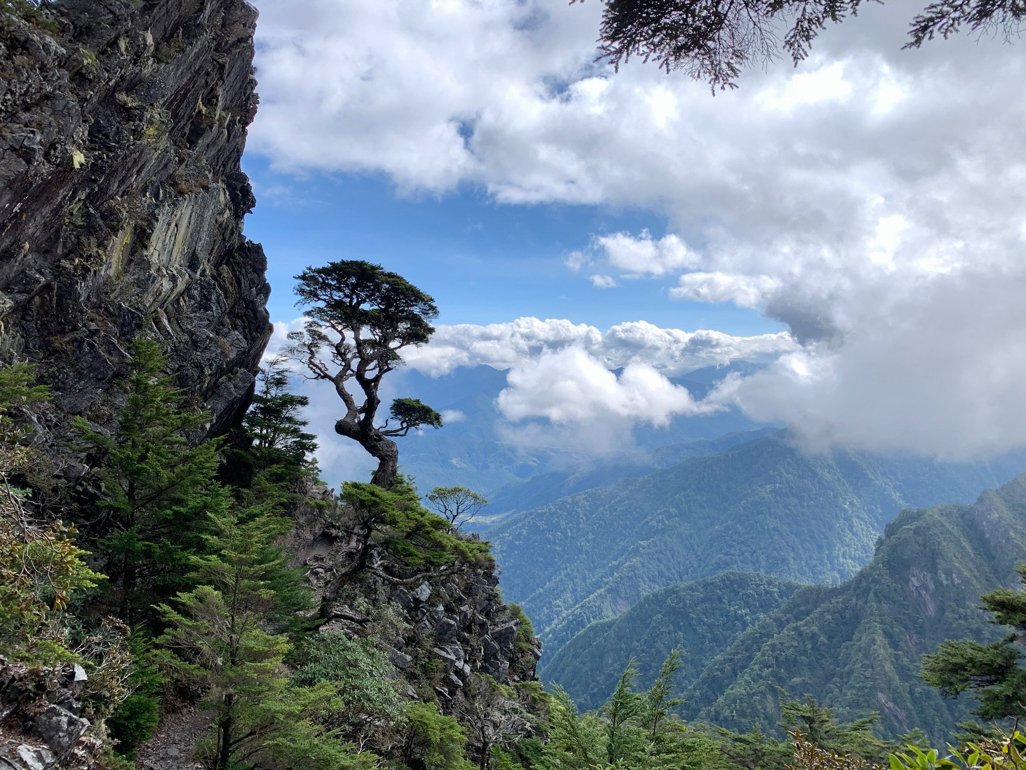
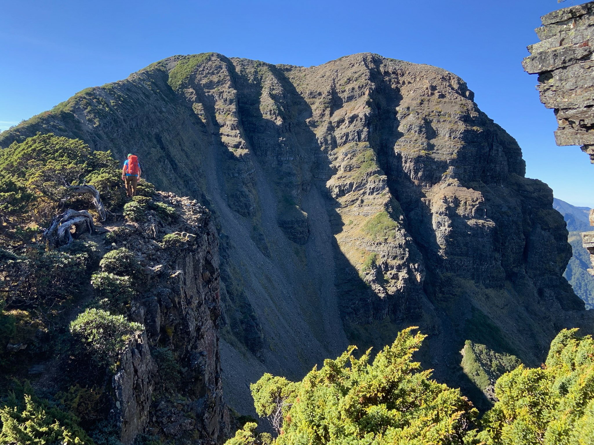
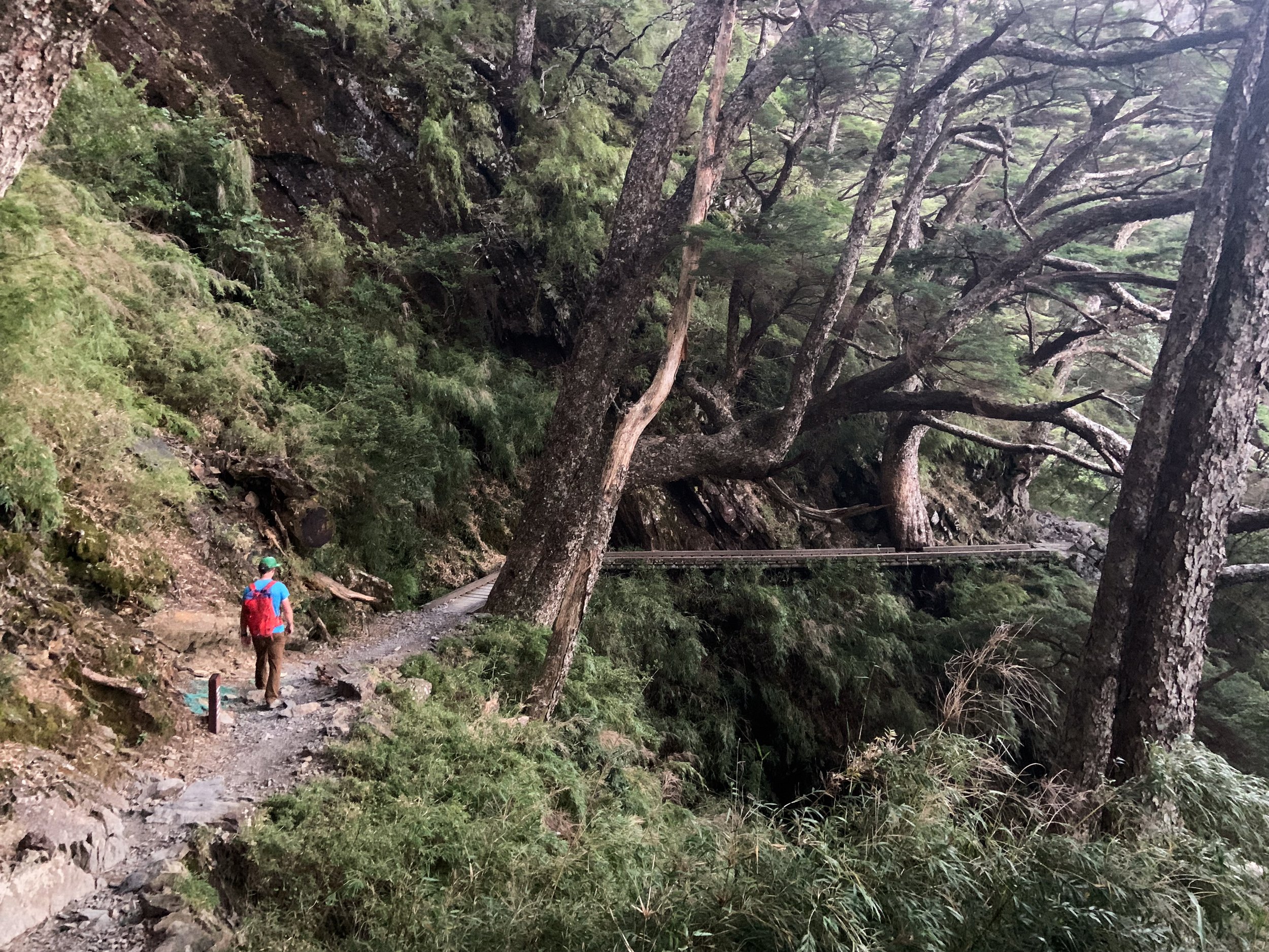
Approaching Xueshan’s north peak.
Our first destination was Taroko Gorge on the mountainous east coast. We had secured permits for the Zhuilu Old Trail. This exposed path had been carved into the steep walls of the gorge during the Japanese occupation. Local Truku tribesmen had rappelled down the cliff and cut out a very narrow trail, in order to open up a route to the interior of Taiwan. Lucky for us, chains had been installed for safety but the less-than-a-metre-wide trail still induced vertigo. We were in dense cloud and could only sense the drop off.
Finally, we reached a broad spot in the forest where we stopped for lunch. We were soon joined by a large cheerful group of middle-aged Taiwanese hikers. We somewhat smugly looked at their massive packs, until they pulled out stoves to cook soup and spread out a huge lunch buffet. We must have looked pathetic with our small lunch as they generously offered us tons of food including delicious Taiwanese sweets. With full bellies, we retraced our steps, clinging to the chains. The clouds had cleared and we could actually see how wild this trail was! It was a skinny ledge clinging to a vertical cliff, with the river 700 metres below.
“Improbably, busses and trucks — and even cyclists — somehow navigate this road. The road is constantly threatened by typhoons, earthquakes and landslides. ”
Next, was our introduction to mountain driving in Taiwan. The Central Cross Island Highway starts at the mouth of the Taroko Gorge at sea level, and in just over 60 kilometres, climbs to 3,000m. It barely clings to the steep mountain sides. While the road is paved, it is mostly single lane, with many bridges and tunnels. It is a constant game of chicken with oncoming traffic and the road is so narrow that one can barely go 25 km/h. Improbably, busses and trucks — and even cyclists — somehow navigate this road. The road is constantly threatened by typhoons, earthquakes and landslides.
Eventually we reached the Central Rift Valley, an area of tea plantations and orchards. Our destination was Wuling Farm, in Shei-Pa National Park, where we would start the Holy Ridge traverse. This multi-day trip has different versions. We had opted for the “O,” which was logistically easiest, as the start and finish are fairly close together. The trail stays above 3,000 meters for its entirety, and ends at Xueshan (Snow Mountain), Taiwan’s second highest peak at 3,886m. A system of mountain huts along the way meant we could travel light.
We started early the next morning: we knew we would have a big day ahead of us, climbing to 3,000 metres to gain the crest of the Holy Ridge. It had taken several months to get the permit, so it felt anticlimactic to drop it into the box at the trailhead which was crammed full of papers and looked like it did not get emptied often. As we gained elevation, the forest changed from fir and hemlock to juniper and rhododendron. We climbed through tunnels of bamboo grass.
“...we had watched the hotel staff fire paintball guns into the forest to chase the monkeys away. Luckily, we did not see any on the trail. ”
At one point we heard the screech of a monkey in the distance. We had seen warning signs about the monkeys. The Formosan Macaque can be a nuisance, attacking people and stealing food, and we had watched the hotel staff fire paintball guns into the forest to chase the monkeys away. Luckily, we did not see any on the trail.
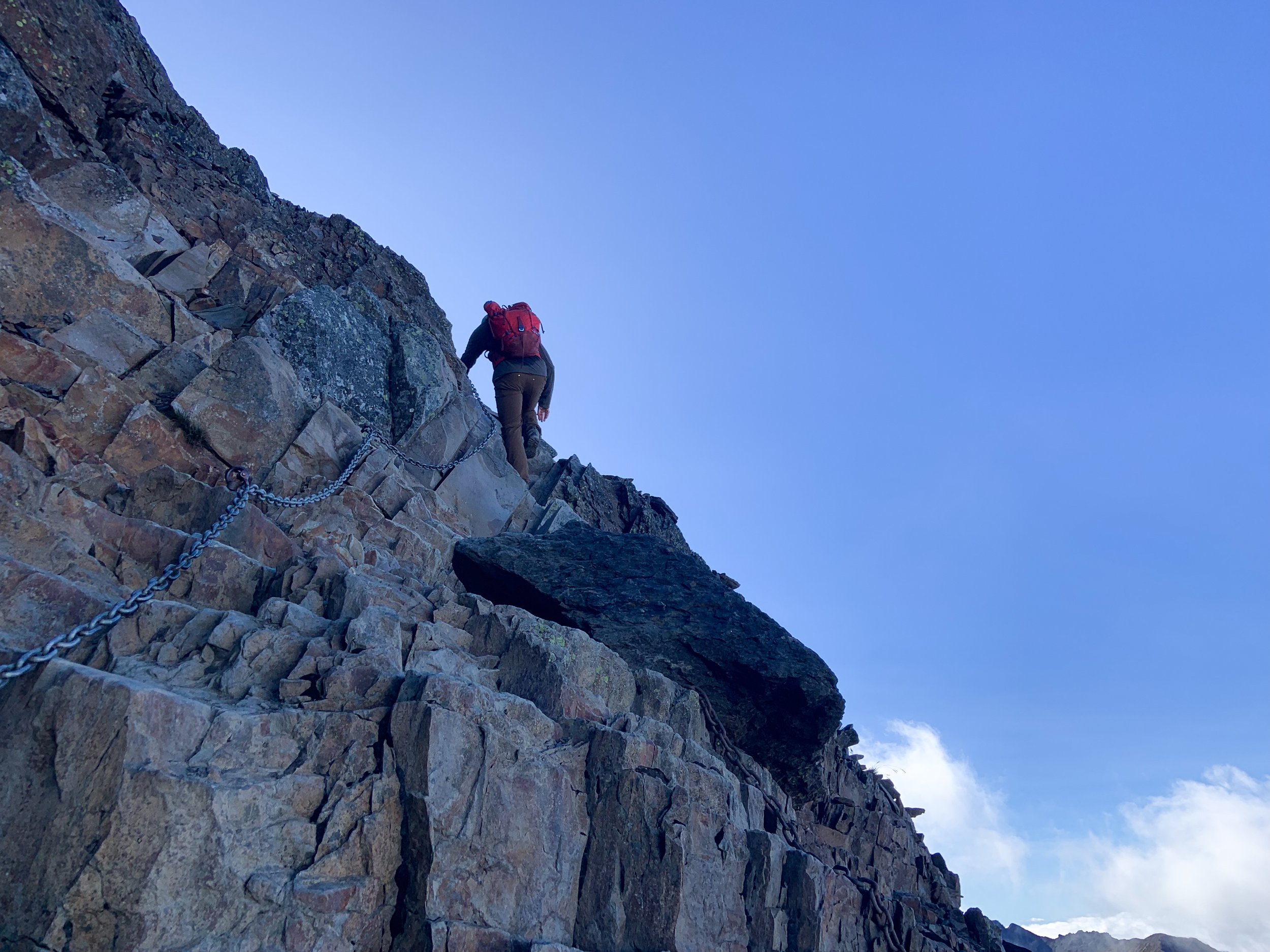
We passed a group of kids with guides and chaperones. They were also going to Xinda Hut, moving slowly with big packs. After several hours of climbing we finally crested the ridge. It was early enough in the day that we had time to summit Mount Chiyou (3,303m). We climbed a talus slope and then walked along a steep dropoff to gain the summit. From there we could see the hut on the ridge below.

Xinda hut.
We arrived in late afternoon. The hut was a large metal A-frame with sleeping space for 34. Cooking was done on picnic tables outside — or in bad weather, under the roof overhang. The cook for the kids’ group was busy preparing an elaborate dinner though there was no sign of the kids yet. We relaxed, cooked dinner, and just as it got dark they arrived, looking absolutely exhausted! For some it was only their second hike ever.
Many Taiwanese people like to be on the summit for sunrise, and the hut was alive with activity by 4:00 a.m. We had no particular desire to start in the dark so we burrowed deeper into our sleeping bags, and waited for first light. As we were making breakfast, we watched the kids standing in a circle in front of the hut, stretching and chanting.

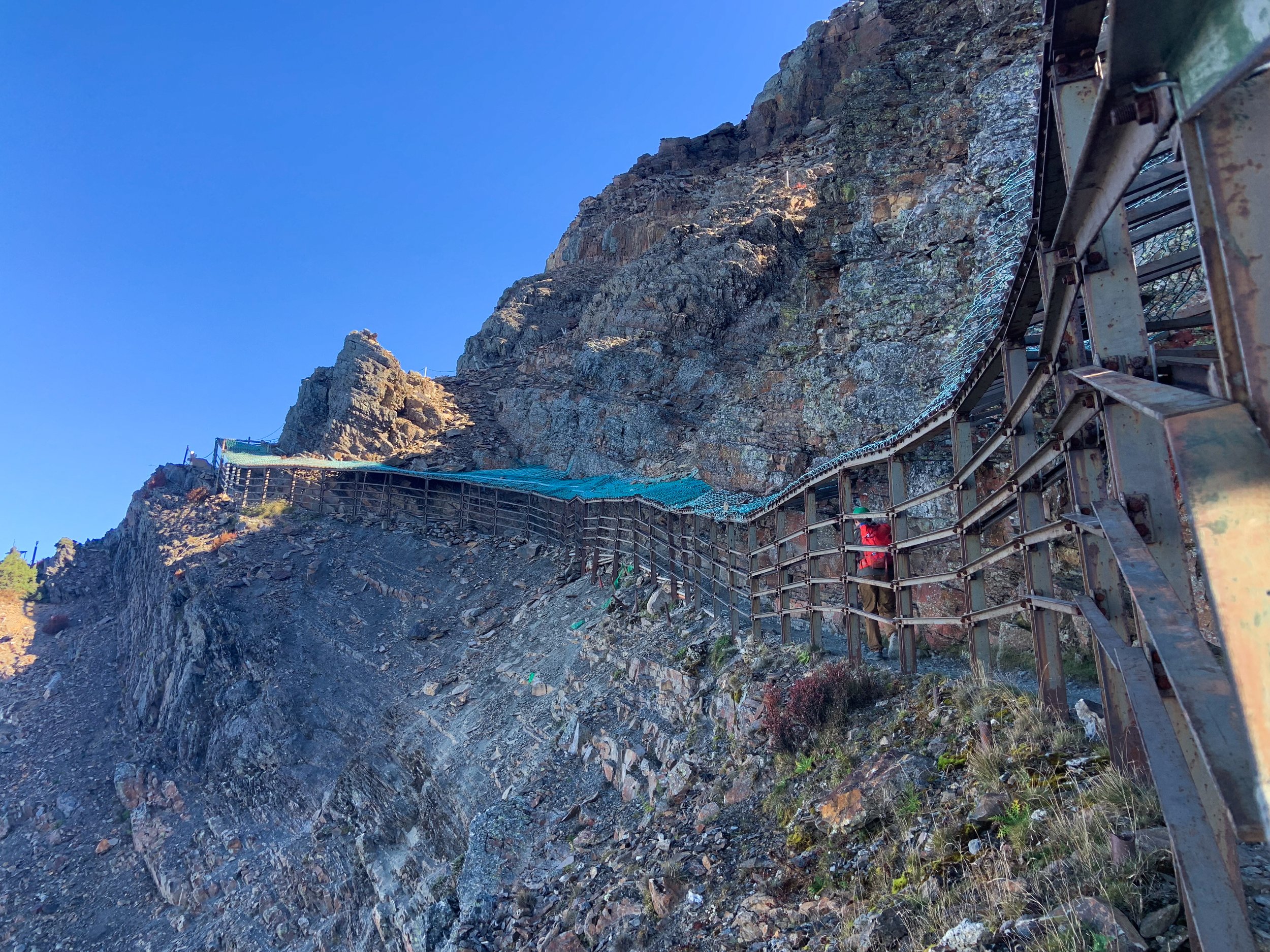
Down climbing the Pintian Cliffs.
After breakfast, we continued along the ridge to the summit of Mount Pintian (3,524m). We did not linger long as we knew the most difficult section of the traverse lay ahead. We climbed down the far side and reached the top of a small cliff with a number of fixed ropes in various states of repair. This cliff was not too difficult. The next cliff was about 10 metres high, vertical, with decent rock. We used one of the fixed lines to lower our packs. The climbing was not hard but the height of the cliff and exposure made it exciting. I was glad to have the rope to hang on to. One more gully followed and then were were through the Pintian Cliffs. Relief!
Mount Dabajian was visible to the north. It is a beautiful rocky peak, featured on the NT$500 bill. It is no longer permitted to climb to the summit as the peak is sacred to the local Indigenous tribes, the Atayal and Saisiyat people.
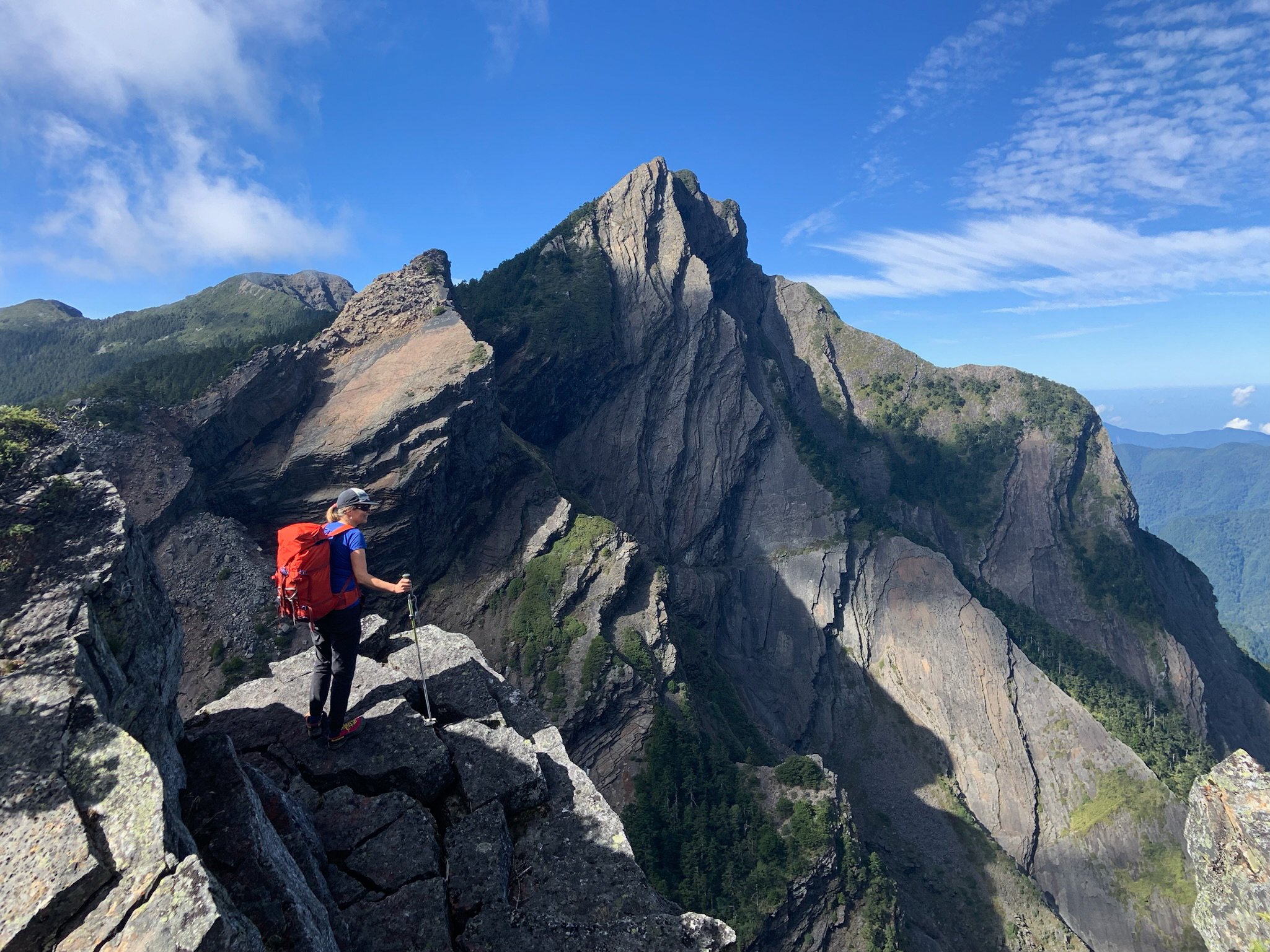
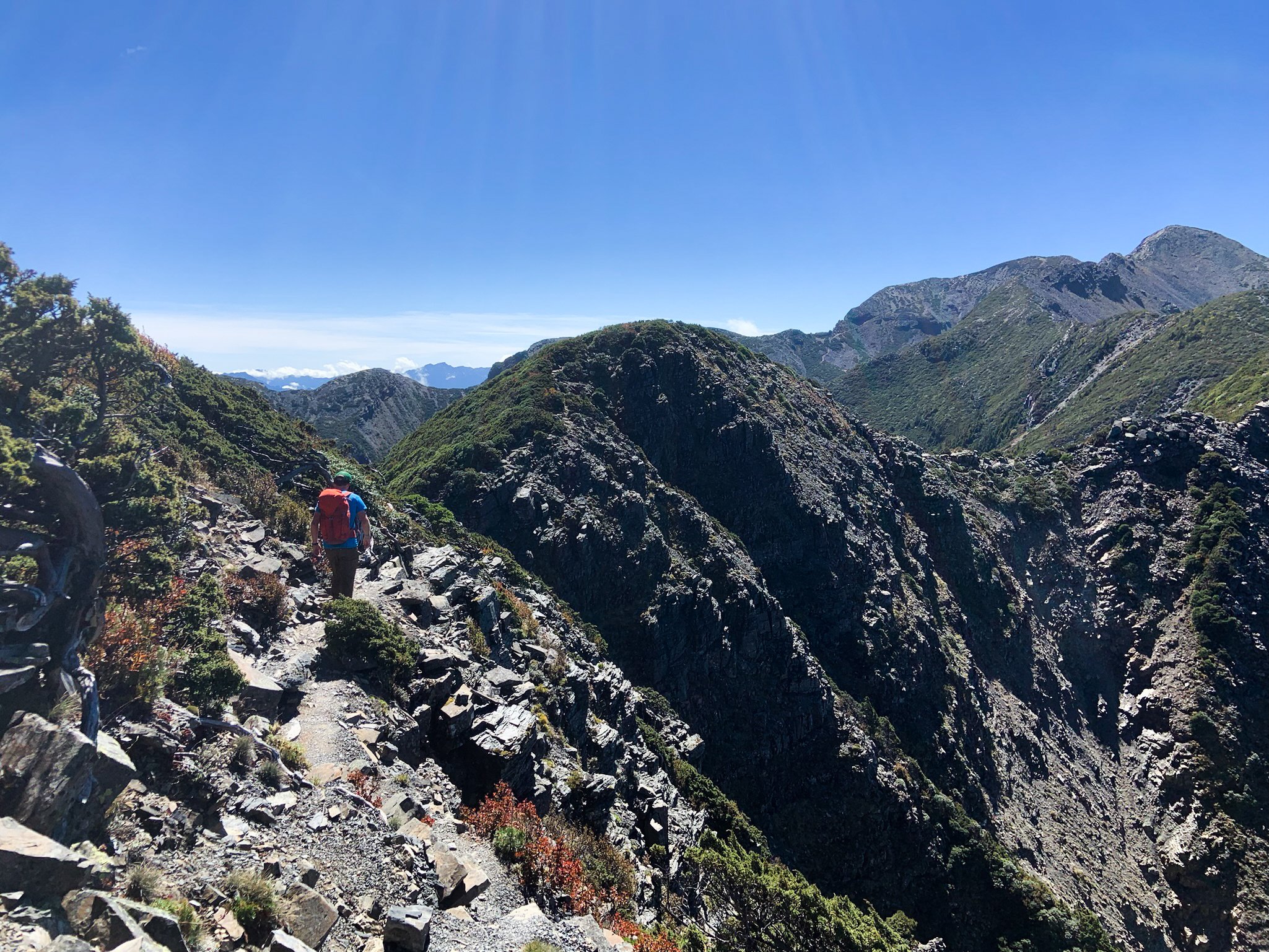
We continued in the opposite direction along the ridge, scrambling up and down short sections. The air was scented by juniper bushes and it was quite warm. We scrambled to the top of Sumida Peak just as clouds rolled in, enveloping us in thick fog.
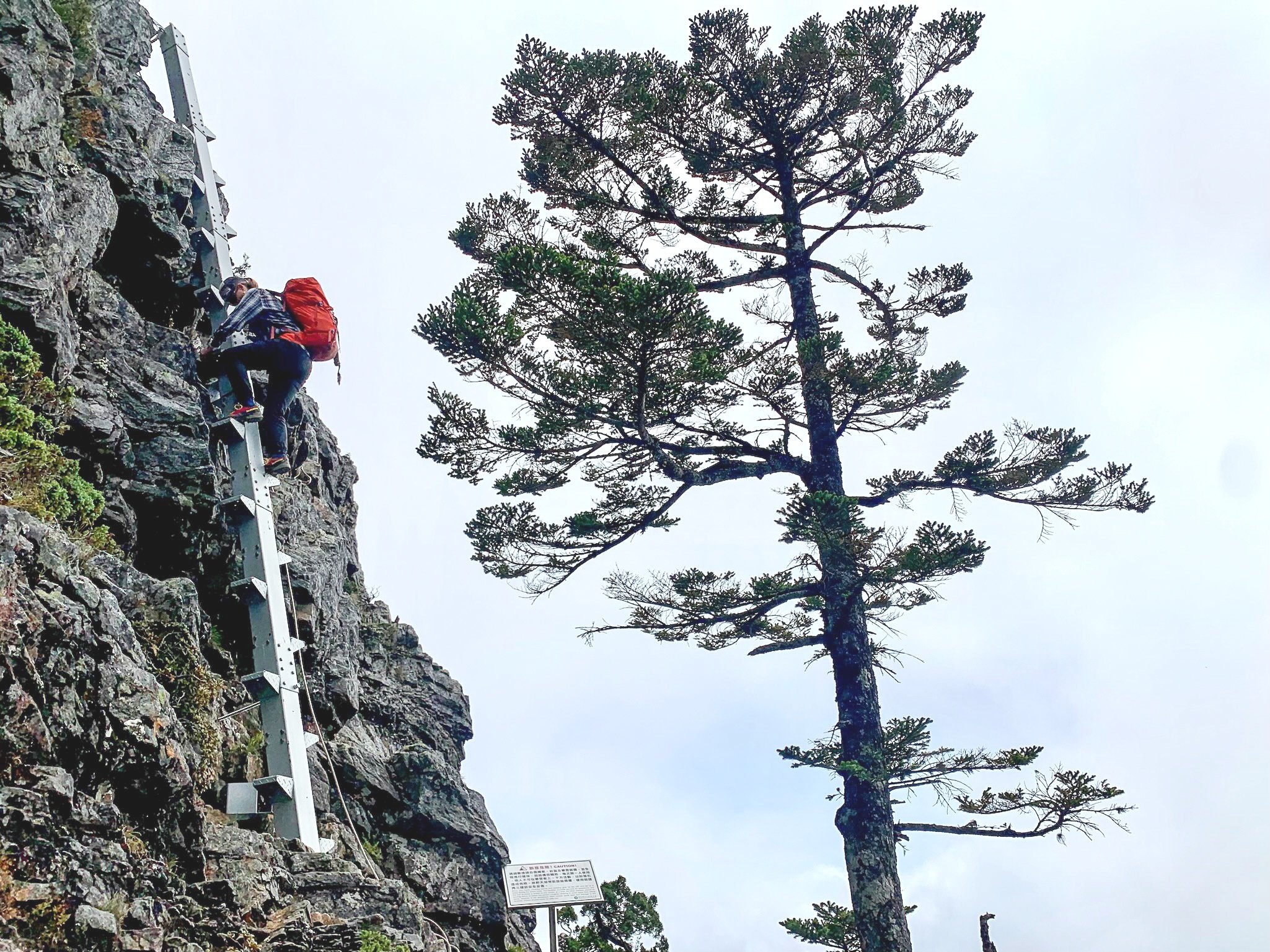
In poor visibility we reached the top of Sumida Cliff. A tangled web of ratty ropes and a few usable ones disappeared over an overhang. Cam went first and reported that giant bolts had been drilled into the rock to serve as footholds. I followed, and together we traversed on rocky ledges to the top of the metal pole. I focused on one step at a time, and tried not to think about how high off the ground I was with only the pole to hang on to. I finally reached the bottom and breathed a sigh of relief. From there, it was a short climb through the forest to Sumida Hut.

The ladder on the Sumida Cliff.

Sumida Hut.
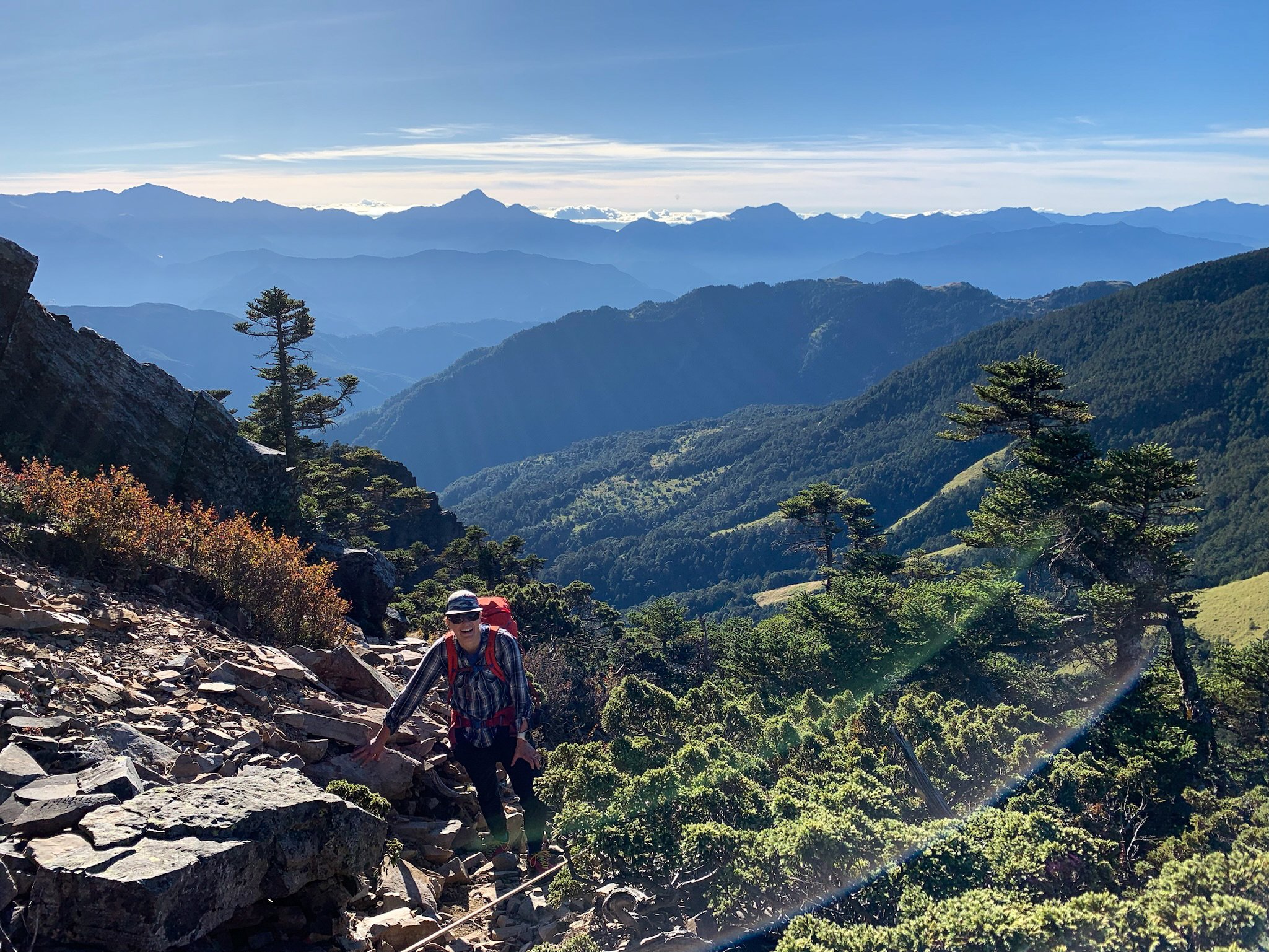
It was only lunch time and we decided to climb Mutalabashan (3,626m), which rose up just behind the hut. It was straight up through juniper bushes. Near the summit, there was some fun scrambling on quartzite. From the summit we had incredible views as the clouds had cleared again. To the west, we could see cities in the coastal plains. To the north, we could even make out Taipei. Endless mountains lay in front of us, including the entire Holy Ridge.
Back at the hut we saw a large weasel which we dubbed the “monkey weasel” as it had a long black tail. It also had a bright yellow neck. We later found out it was a Formosan yellow throated marten, a rare species only found in Taiwan.
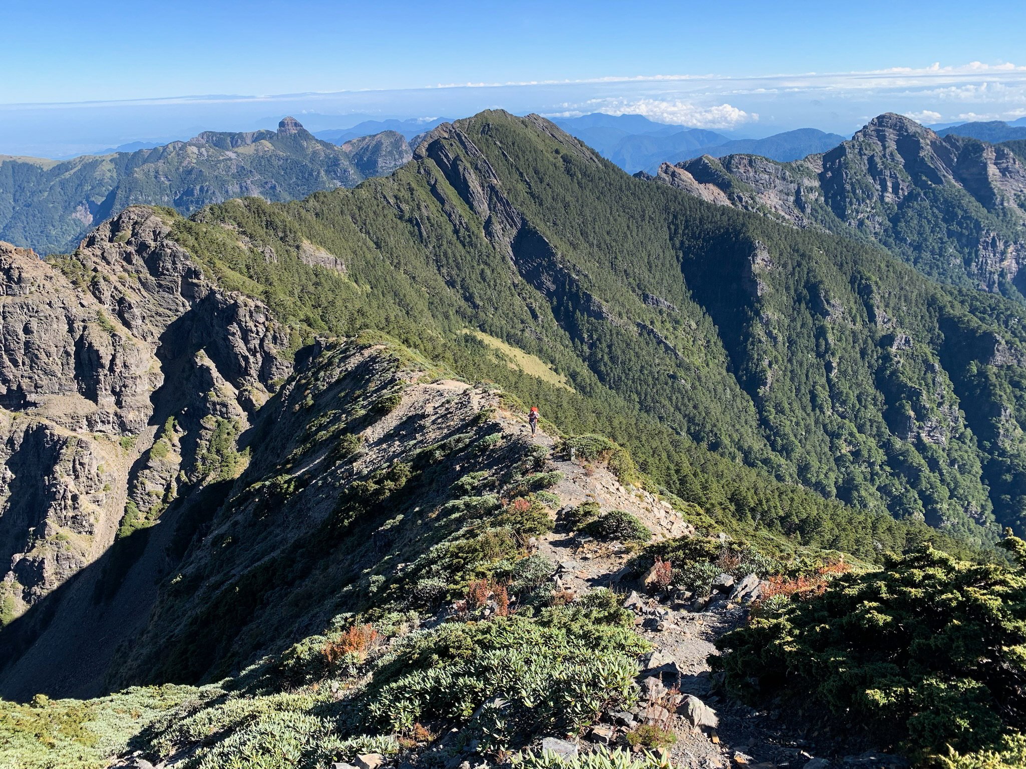
The next day we continued south along the ridge. We knew the most technical parts were behind us, but there were still surprises, such as a long, loose gully which we down-climbed one at a time. As we got closer to Xueshan, we saw more and more people. We tagged Xue North Peak (3,703m) and bypassed the hut at its base. We climbed the peak called “north corner of Xue” which was quite prominent for such a nondescript name, and almost as high as the main peak.
From the summit we climbed down to reach Cuei Pond. We had to drop down the far side of the ridge for several hundred metres, which we would have to regain the next morning, but we had been told that this hut was in a beautiful spot. We descended into a small cirque, and found the hut in a grove of ancient juniper trees, with the pond nearby. Near the hut we saw a small animal which looked like a small deer with horns. It was a Formosan Serow, a rare goat-antelope.

Cam on the porch at Cuei Hut.

A Formosan Serow.
At the hut we met another group, with their guide and porters. We had already seen several porters along the trail. They carried enormous loads while hiking in Crocs or rubber boots, and they often smoked. They set up to cook dinner, stir-frying fresh vegetables and meat. They offered us food. I declined as I had a bit of a headache and nausea but Cam was happy to try their food and declared it to be the best meal he had in Taiwan. The hut was full, and I regretted not bringing ear plugs as there was a lot of snoring. We again heard people getting up at 4:00 a.m., but rolled over and went back to sleep. When we woke up at 6:00, we looked up and found that the hut was empty. Everyone but us had already left!
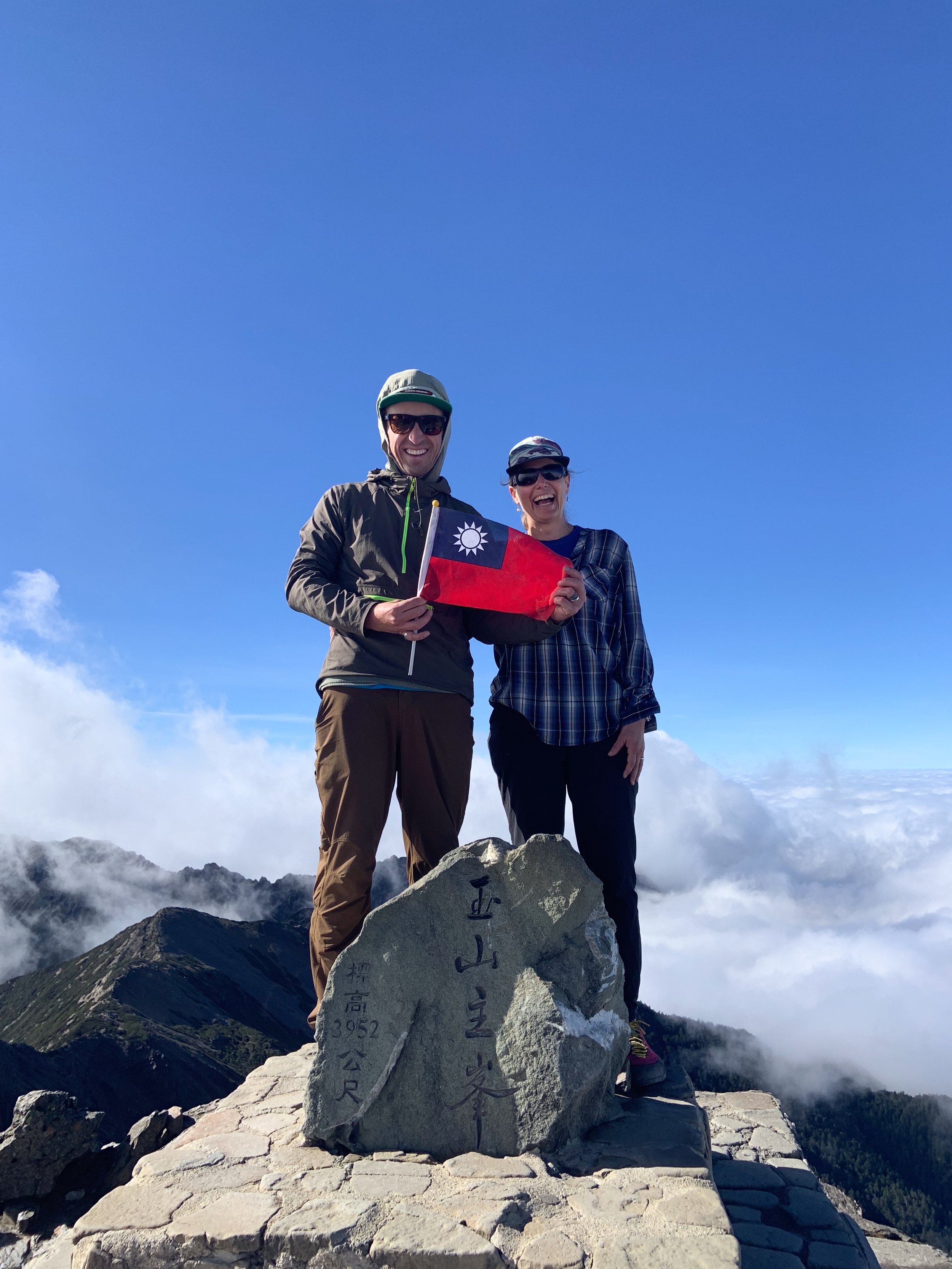
It was a cold morning and there was frost on the ground. From the hut, we climbed back up and gained the summit of Xueshan. The views were fantastic and we lingered in the sunshine. To the south we could see Yushan (Jade Mountain), the highest peak in Taiwan at 3,952m. We descended via the popular main trail, meeting all kinds of people along the way. There were young, urban types in ultralight gear and large groups of middle-aged hikers with all kinds of things hanging off their packs: cups, walkie talkies, umbrellas and cameras. Rain covers were popular even though the weather was good. We saw people hiking in rubber boots. We saw an older couple carrying just a water bottle and hiking in jeans. However, we had met no other foreigners. We felt like minor celebrities as many locals wanted to take our picture.
Our next objective was Yushan. It is the highest mountain in Northeast Asia — 180 metres taller than Mount Fuji — and as such it is very popular and permits are hard to come by. Most people do the climb in two days, overnighting at Paiyun Lodge; a huge modern hut that sleeps 116 people. We had entered a lottery for a spot at Paiyun Lodge but then found out you could do the climb in one day. It would be a big day — a 26-km roundtrip with 1,500 metres of elevation gain — but we figured we’d be acclimatized from the traverse.
The hostel at the trailhead was a beehive of nervous energy as we organized for the climb the next day. You have to pass Paiyun Lodge by 10:00 a.m. or you are not allowed to continue to the summit, so we decided to leave at three in the morning. We were finally becoming Taiwanese mountaineers!
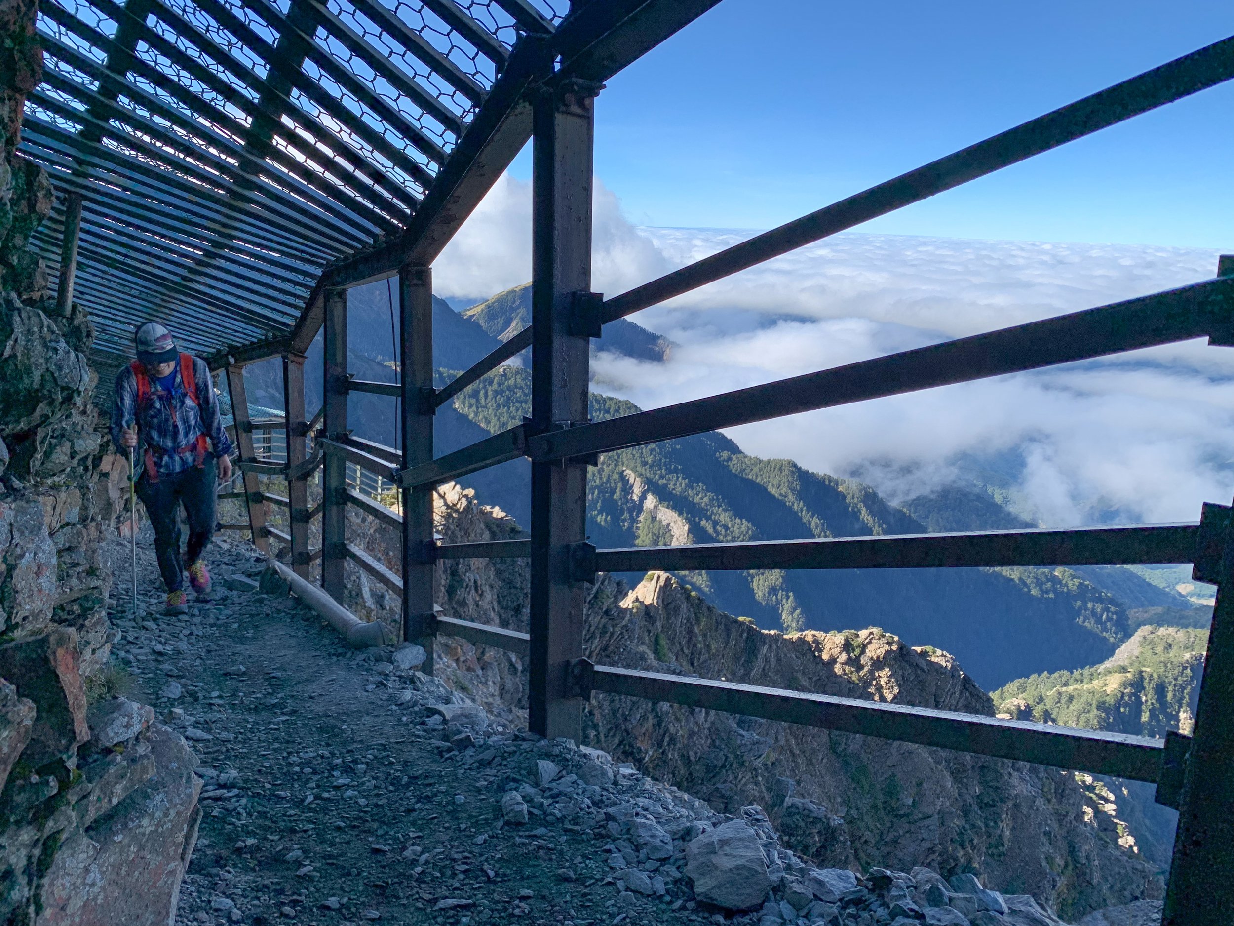
It was surreal climbing in the dark. The trail was well built though we could sense a big drop-off to one side. We made good progress and reached Paiyun Lodge by seven o’clock in the morning. We had our permits checked and then continued on to the summit. Most people who do the climb in two days leave at 2:00 a.m. to be on the summit for sunrise. We saw many people already on their way down from the summit, including a large group of Japanese seniors, and several families. Near the summit of Yushan we passed through a metal cage which protects the route from rock fall. Above the cage, chains have been installed for safety.
We finally stood on the summit at nine o’clock. Clouds swirled below us but we were in the sun. We lingered for a while. When we descended, we met a Taiwanese family with two small girls. We were surprised to see them, as we had noticed them at the hostel the night before. The mother proudly told us that the girls were five and seven years old and they had done the whole climb in one go, just as we had! It was the older girl’s birthday wish to climb Yushan. We were quite impressed.
“Mountaineering in Taiwan is an incredible experience. The mountains are beautiful, with lush tropical vegetation at lower elevations and hemlock, juniper and rhododendron at higher elevation.”
Mountaineering in Taiwan is an incredible experience. The mountains are beautiful, with lush tropical vegetation at lower elevations and hemlock, juniper and rhododendron at higher elevation. We saw rare animals unique to Taiwan. Most importantly, we got to share in the mountain experience that is common to all of us who love mountains. It was interesting to experience Taiwanese mountain culture with its quirks such as the habit to get up super early, and the tendency to bring tons of food to share. The people we met on the trail were incredibly friendly. There is a lot of uncertainty in that part of the world right now but despite that, I would encourage anyone to visit Taiwan’s mountains if they get the chance.
If You Go
Apply for permits well in advance. The national parks website is in English and the online process is straightforward. For popular routes such as Yushan, Zhuilu Old Trail, or Xueshan main trail, foreigners can apply four months in advance. For other routes including the Holy Ridge (also called called Shengleng) you can apply two months in advance.
Some trails, including Yushan, require a police permit in addition to the national park permit. This is a holdover from Taiwan’s martial law era when access to the mountains was restricted. The easiest is to click the button at the bottom of the national park permit which then does this automatically for you.
The huts on the Holy Ridge are free. Bring your own cooking gear, mats, sleeping bags and food. Water is supplied by nearby ponds or rainwater collection. Ear plugs recommended.
Download Google Translate and make your translations to traditional Chinese (rather than simplified Chinese). The camera function is useful for deciphering signs. You can translate webpages through the browser, and if you highlight text in an email, your phone will give you a translate option. Few people seemed to speak English very well in the mountains.
The trails and routes are generally well signed, but having a Gaia or AllTrails app is helpful.
While there are public transport options to access the mountains, renting a car gives you the most flexibility. You need an international driver’s permit. Driving Taiwanese mountain roads is not for the faint of heart. Road signs are in Chinese and English.
Be aware that the English spelling of many peaks and places varies significantly. For example, Mount Xue can also be written as Syue or Hsieh, Sumida as Samita, Cuei Pond as Tsui Pond, etc.
Wuling National Hostel makes a good base in Shei Pa National Park. It has private rooms, and dinner and breakfast is included.
Dong Pu Hostel is the only option at the Yushan trailhead.
Taiwan has excellent coffee.
Carrefour in Taipei is a good place to buy food. 7-Eleven is ubiquitous, even in the smallest towns, and is a good place to stock up on pre-packaged lunch foods and snacks. They usually have free WiFi and an ATM. Decathlon in Taipei sells gas canisters for stoves.
Stefanie Mclellan
Stefanie Mclellan is a physician in Invermere, BC. She likes exploring the Purcells with her husband Cam, both on skis and on foot, and enjoys reading maps and old guidebooks.
Stefanie Mclellan est médecin à Invermere, C.-B. Elle aime explorer les monts Purcell en ski ou à pied avec Cam, son mari, ainsi que lire des cartes et feuilleter de vieux gu